The Ireland Way
  • DISCOVER
  • TRAIL
  • SHOP
  • NEWS
  • FAQ

Let Your Journey Begin!
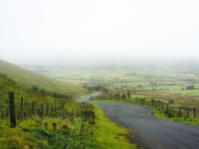
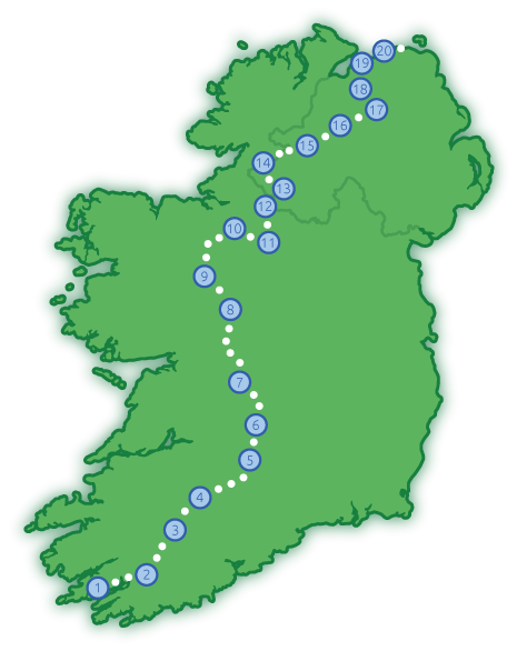
40 DAYS
14 COUNTIES
620 MILES
1,000KILOMETRES
10,000+  SHEEP
Route Map of the Ireland Way Hiking Trail
40 LÁ
14 CONTAE
620 MÍLE
1,000CILIMÉADAR
10,000+  CAORACH
Picture

Part 1:

​Beara-Breifne Way

Caha Mountains on the Ireland Way Hiking Trail

1) ​Beara Way

Castletownbere to Kealkill
Distance: 57.5km, 35.7 miles
Days: 3
County: Cork
More information & Video

Trail Highlights

Wedge tomb
Views from Caha Mountains
Park Lough
Lough Toberavanaha
​Glengarriff Forest Park
Chapel on Gougane Barra Lake The Ireland Way Hiking Trail

2) Slí Gaeltacht Mhuscraí

Kealkill to Millstreet
Distance: 71.6km, 44.5 miles
Days: 3
County: Cork
More information & Video

Trail Highlights

Carriganass Castle
Gougane Barra
​Famine Pot
St. Gobnait's Well
River Blackwater on the Ireland Way Hiking Trail

3) North West Cork Way

Millstreet to John's Bridge
Distance: 40.2 km, 25 miles
Days: 2
County: Cork
More information & VIDEO

Trail Highlights

River Blackwater
Picture

4) Ballyhoura Way

John's Bridge to Tipperary
Distance: 87.2 km, 54.2 miles
Days: 4
Counties: Cork, Limerick, Tipperary
More information

Trail Highlights

Liscarroll Castle
Donkey Sanctuary
Ballyhoura Mountains
Castle Oliver Gate House
Ballylanders Church Ruin
Glen of Aherlow
​Ogham Stone
Donohill Motte on the Ireland Way hiking trail

5) Multeen Way

Tipperary to Milestone
Distance: 35.5 km, 22.1 miles
Days: 1
County: Tipperary
More information

Trail Highlights

Tipperary Town
Donohill Motte
​St. James' Well

Cloughjordan Eco-Village on the Ireland Way hiking trail

6) Ormond Way

Milestone to Portumna
Distance: 85.8 km, 53.3 miles
Days: 2
Counties: Tipperary, Galway
More information

Trail Highlights

Augustinian Priory
​Cloughjordan Eco-Village

Ballinasloe on the Ireland Way Hiking Trail

7) Hymany Way

Portumna to Ballygar
Distance: 100.4 km, 62 miles
Days: 4
County: Galway
More information

Trail Highlights

River Shannon
Portumna Castle
Portumna Forest Park
Brackloon Castle
St. Brendan's Tree
​St. Brendan's Cathedral
Glinsk Castle on the Ireland Way Hiking Trail

8) Suck Valley Way

Ballygar to Loughglynn
Distance: 66.5 km, 41.3 miles
Days: 3
County: Galway, Roscommon
More information

Trail Highlights

​Glinsk Castle
Traditional Telephone Box
Ballymoe Church Ruin
Moygara Castle on the Ireland Way Hiking Trail

9) Lung/Lough Gara Way

Loughglynn to Castlebaldwin
Distance: 44.6 km, 27.7 miles
Days: 2
County: Roscommon
More information

Trail Highlights

Moygara Castle

10) Miner's Way

Ballinafad to Leitrim Town
​Distance: 54.4 km, 33.8 miles

Days: 2
Counties: Sligo, Roscommon, Leitrim
More information

Trail Highlights

Ballinafad Castle
Megalithic Cemetery
​Donkey Sanctuary
​St. Lasair's Holy Well
​Kilronan Abbey
Monument commemorating the March of O'Sullivan Beare in 1602 The Ireland Way

11) Under Re-development
& the Shannon Blueway

Leitrim Town to Dowra
​Distance: 25.7 km, 16 miles

Days: 1
Counties: Leitrim, Cavan
More information

Trail Highlights

​Wall of O'Rourkes Castle
​​Lough Allen

Lough Allen Canal
​Acres Lake
Picture

12) Cavan Way

Dowra to Blacklion
​Distance: 22.3 km, 13.9 miles

Days: 1
Counties: Cavan, Fermanagh
More information

Trail Highlights

Shannon Pot
​Cavan Burren Park

​Giant's Leap
Lough Macnean
Picture

Part 2:

The Ulster Way

Belleek Pottery Centre on the Ireland Way Hiking Trail

13) Big Dog Way

Bellcoo to Belleek
​Distance: 45.9 km , 28.5 miles

Days: 2
County: Fermanagh
More information

Trail Highlights

Ballintempo Forest
Big Dog Mountain
​Belleek Pottery
Lakeland Way on the Ireland Way Hiking Trail

14) Link Section

Belleek to Lough Bradan Forest
​Distance: 50.6 km, 31.4 miles

Days: 1
County: Fermanagh
Link Section: no walking trail
More information

Trail Highlights

Belleek Pottery
Many lakes
​Drumskinny Stone Circle
Path on the Ireland Way Hiking Trail

15) South Sperrins Way

Lough Bradan to Gortin
​Distance: 56.2 km, 34.9 miles

Days: 2
​County: Tyrone
More information

Trail Highlights

View from Bolaght Mountain
View from Bessy Bell
Moneyneany Church on the Ireland Way Hiking Trail

16) Glenelly Valley Way

Gortin to Moneyneany
​Distance: 36.6 km, 22.7 miles

Days: 2
County: Derry
More information

Trail Highlights

Glenelly Valley
Ring forts
Central Sperrins Way on the Ireland Way Hiking Trail

17) Central Sperrins Way

Moneyneany to Dungiven
​Distance: 20.8 km, 12.9 miles

Days: 1
County: Derry
More information

Trail Highlights

​Sperrin Mountains
​River Roe
Dungiven Castle on the Ireland Way Hiking Trail

18) North Sperrins Way

Dungiven to Castlerock
​Distance: 56.1 km, 34.9 miles

Days: 2
County: Derry
More information

Trail Highlights

Sperrin Mountains
Legavannon Pot
Dungiven Castle
​Gortmore Viewpoint
Castlerock Beach on the Ireland Way Hiking Trail

19) Link Section

Castlerock to Portstewart
​Distance: 16.2 km, 10.1 miles

Days: 1
County: Derry
More information

Trail Highlights

Castlerock Beach
​Coleraine Town
​Mussenden Temple
Giant's Causeway on the Ireland Way Hiking Trail

20) Causeway Coast Way

Portstewart to Ballycastle
​Distance: 49.4 km, 30.7 miles

Days: 2
Counties: Derry, Antrim
More information on WalkNI.com

Trail Highlights

Dunluce Castle
Giant's Causeway
Smallest Church
White Park Bay Beach
Carrick-a-Rede Rope Bridge
Trail end-point Children of Lir statue

Get The Guidebook >

Social

Picture
Facebook
Picture
Instagram
Picture
Twitter
Picture
Tripadvisor
Picture
Pinterest

About

About Us
Contact Us
Legal Terms
Picture
Picture
Picture
Picture
Ireland Way © 2021. Ireland Way is a Registered Trademark.
  • DISCOVER
  • TRAIL
  • SHOP
  • NEWS
  • FAQ